FALL DATA LOGGING OF YOUR SOILS
Oct 14, 2019
Developing a better map for maximized crop productivity management. That’s the premise behind data logging, says Agtegra sales agronomist Preston Barragan. “This is the next technology progression from just using basic satellite imagery maps to make management decisions,” says Barragan.
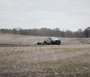
Data logging is one of multiple components that go into the cooperative’s full-on MZB® zone maps. Using a Veris Technologies soil cart, the unit is pulled across a customer’s field in 60-foot swaths. Its sensors assess soil electrical conductivity (EC) readings, which measure water holding capacity, soil cation exchange (CEC) and other soil properties that affect crop productivity. EC readings are taken at both shallow and deeper subsoil depths.
Besides the two data logging measurements, the complete mapping system also utilizes RTK elevation and GNDVI satellite imagery, which measures green matter/crop vigor characteristics. The final mapping piece is yield data for yield potential. These layers combine, says Barragan, to produce a map that has up to 12 different yield management zones.
“These maps are pretty eye-opening to growers, once they see all the information,” says Barragan. “They know there’s variability out in their fields, but this really quantifies it, and changes the mindset of managing a field as if the soil is all the same.”
That soil variability translates into matching variable rates of seed, multi-hybrid management and nutrients to the potential of each zone, helping save input dollars on the lower yielding areas of a field. “Pretty much we’ve reached the point where any form of variable rate application is better than no variable rating,” says Barragan. “But the technology behind this mapping allows you, with exacting precision, to tightly manage your inputs for the most return.”
Fall is generally considered prime time for data logging, notes Barragan. The crops are generally off the fields, soil samples can be taken and fall fertilization can help with spring’s inevitable time window crunch. Detailed crop plans can be developed over winter, with variable prescription rates of seed and fertility written and aligned for the data-logged mapping zones.
However, this has been anything but a ‘normal’ fall or year. Barragan is empathetic and realistic, like all Agtegra’s agronomists, that decisions to go forward with this level of mapping may be challenging this year. “We know what a tough year it’s been. But there’s so much value to what you get by running that cart over your acres. We’re using science to identify where best to apply more and less inputs,” he explains.
It’s a technology, says Barragan, that once used, seems to sell itself. “About every single person I’ve worked with that’s used it, once they’ve seen how they can comprehensively shift their field zone management to take better advantage of their dollars, wants to add more acres to the data logging schedule,” says Barragan.
While the data logging component will create the most complete map, Agtegra also offers less layered approaches to mapping. “You won’t get the detail created through data logging and the complete mapping system, but they can still be good options,” says Barragan.